But seriously, if they had to pick a day to give us an extra, unexpected 10 miles, this was a good day to do it. We crossed 1 Appalachian ridge and bypassed another using the Rails to Trails paths.
Ro and I separated in the morning -- he needed to wait until the hardware stores opened in town to get his bike fixed, and I am a fairly slow rider (avg. 13-15mph) so I got out early and he broke camp, figuring he'd catch up to me by lunchtime.
Getting out of Washington was interesting -- the topo showed lots of up and downs (aka steep rolling hills), but it was all through residential and business areas. San Francisco can't beat some of these hills. This is in the east, so their version of Lombard Street would be straight. *grin* But, we eventually left town. My Pit .5 was at a gas station which I'd thought was simply well-located but I knew was even better than that when I saw the next-door decoration. The station attendent handed me the bathroom key before I could say a word when I entered. *grin*. He'd already had quite a few bikers come in already.
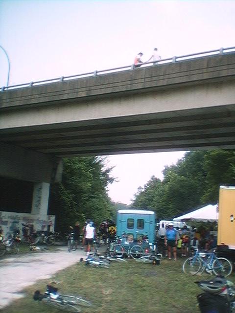
Much of the day was spent following I-70 on parallelish roads and eventually Old Hwy 71. Most of these roads were one-lane wide 2-direction roads, but there was little to no traffic on them. I did get a direct justification for safe riding, though, when I was braking on a steep twisting downhill (because I couldn't see far in front of me up the road) when a Large Yellow Thing (farm equipment?) with Really Big Tires pulled around the sharp right-hand-turn below me. No problem, really -- I slowed more, and made the turn and didn't get squished. Some of these silly bikers could have been. The roads did eventually widen as we got to more residential areas, and we got once again moved to the sidewalk as we crossed the Monongahela River, because of the steel grate bridge deck. It's not like you *can't* ride on them, you can ride on it but you can't really turn sharply or correct quickly -- resources useful to have sometimes. The bridge is really pretty, though.
Pit 2 was at the trailhead of the first Rails to Trails segment we were to take, the YRT. This stands for Youghiogheny River Trail, and it is a packed-gravel trail which while unpaved is rather easy to ride on. It's also absolutely beautiful, but I did manage to limit myself to only a couple of representative pictures. This stretch was only about 6 miles long, ending in Jacob Creek, which hosted the only biker-aid sign considered better than Free Lemonade. *grin*
Ro had caught up by lunchtime, but I had finished my lunch and was ready to go, so I left and he was again to catch up later, and not work as hard at it this time (since he wasn't going to be 3 hours behind me like he was at the start of the day). He'd found an excellent hardware store in town called "West Washington Hardware", where the co-owner/manager/really-good-guy-at-fixing-bicycles (acc. to Ro) Tom Rogers helped him fix his shifter cable stop by drilling a hole through the down tube and fastening a bolt through the tube with a washer, nut, lockwasher, and capnut. Viola, and everything was happy, and Ro had come barrelling up the hills to catch up to me (he's really fast when I'm not in front of him).
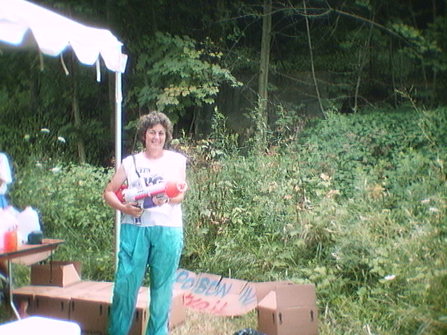
He caught up to me again at almost the last of the hills we had to climb for that first Appalachian Ridge, so we rode down to Dawson and Pit 3, which was located at the trailhead for the second YRT stretch, which ended at Confluence. Not only did they have an ice cream truck on-hand, but the theme of the day was Hydrate And/Or Die, with the SuperSoakers ready to make the point. Needless to say several water fights were fought. Everyone was relaxing because we all had plenty of time to make it to camp, and it was still a beautiful day. We had 26 miles to camp, 22 of it on the trail, and life was good.
Well, it was, mostly. The view of the river was mostly blocked from the trees, but a couple of spectacular overlooks were well-populated by resting bikers. We ride to the end of the trail at the 82 mile mark, and are then met in the parking lot by a ride staffer who has the unfortunate job to tell us that it's 13 miles to camp, not 3. Apparently a "0" on our map was supposed to be a "10". 10 more miles on the YRT is not a really bad thing, of course, but at this point people rare tired and hungry (because many of us time our food so we eat right as we get into camp). Ro and I stopped to get ice cream, and I saw Larry the Route Staff Dude at the Visitor's Center for the trail/parks located nearby, so I did ask him to call ahead and request that the food truck stay open an hour later since people *would* have either left earlier or hurried more if they'd known it would be an extra 10 miles. He agreed, and called it up. Good thing, too -- one person was extremely irate about it in camp that night during announcements, and the hour extension had already been in place, but he hadn't found that out yet. Anyway.
We got in before dark, although people were still coming in at 9pm that night who'd had to go get food before they were able to continue on. We were camping in the Turkeyfoot Valley Area Schools near Confluence that night and the next, before tackling the last 4 Appalachian ridges.